Friday, October 28, 2022

Hydroecology of Springs with Dr. Abe Springer


Fig. 1: Rattelesnake Creek in Greenough Park, at location of our field excursion with Dr. Springer


This week we had the opportunity to learn from Dr. Abe Springer, an ecohydrolgist from Northern Arizona University. After a lecture at UM, we headed to the field where Springer taught about specific protocols for measuring the health of springs. Springs usually have quite a bit more biodiversity than other areas, with several species being reliant on the spring for part of their lives. One thing that makes them particularly special is the fact that they are found where groundwater and surface water interact, this often leads to areas that have warmer water in the winter than the surrounding surface water.


Fig. 2: Abe Springer lectures at UM about spring geology, hydrology, and ecology!

The method that Abe showed us to analyze springs was a very multi-disciplinary approach. In the first part of the outing we covered how to create a general overview of the site, including site and land information, weather conditions, and a detailed site map. The methods that were used were surprisingly similar to the methods that WEN uses to sample our Stream Team surface water sites. After the site was mapped and described, we split into four teams to do more specific sampling, with local experts leading each station. These also looked very similar to Stream Team.


Fig 3 and 4: Students survey the area of interest in Greenough Park. On right, UM Geology Student and WEN intern, Aaron Henderson, speaks with UM Hydrology Professor Bill Woessner

Deb and I of WEN led a bug collection, which was actually quite difficult in the area. The spring in Greenough Park is very low flowing this time of year, and most of the bugs were more like pond species (flatworms, threadworms, crane-flies, riffle beetles etc.). We sampled both near the mouth of the spring, where it hit the trail, and its headwaters, about 50 feet up the hillside. Another group led a chemistry analysis (dissolved oxygen, pH, temp, specific conductivity) as well as a measure of flow. A third group, led by Vicki Watson, looked at the vegetation community present at the site, identifying as many species as possible. The final group was mostly geology students from the UM, including WEN intern Aaron Henderson. They looked at the geology of the site to form a better picture of how the spring was formed.


Fig. 5: Bug collection, as seen above, looks a bit different than when we collect from the streams!


After each group finished up their sampling we got together into a large group and shared our findings. All of this information got combined into one dataset to be entered into the Springs database, springstewardshipinstitute.org .

Friday, October 21, 2022

Science Friday: Stream Velocity


Happy Science Friday! Today we will be learning about stream velocity - the speed in which the river flows over a period of time. This variable is crucial in understanding the biological makeup of the river, as some organisms need fast flows and others need stiller pools. 


The velocity of the stream is directly related to how much water is flowing through, which is why monitoring this variable is important, as it’s always changing! As snow melts during the spring, more water is flowing to our streams creating a faster velocity. The end of summer and fall marks much lower streams and slower velocities. 


Other than the biological makeup of the stream, velocity also determines the amount of sediment that is carried by the stream. Faster streams will cause sediment to be suspended in the water column and thus carried further, whereas slower streams will allow sediment to settle to the bottom.


Fig. 1 Bends and turns in the stream’s channel provide variation in flow, thus variation in habitability. 


The speed of water also relates to last week’s Science Friday topic, dissolved oxygen (DO)! With a faster stream, more ambient oxygen will be aerated into the water causing an increase in DO levels.  


Stream Teams with WEN test velocity of Rattlesnake Creek every Sunday! We do this by marking a beginning and end of the section we are monitoring, and timing how fast it takes for a tennis ball - mimicking a molecule of water -  to reach the other end, as seen below:


Tuesday, September 6, 2022

Porosity and Permeability


It is truly amazing that the Missoula Valley Aquifer can support more than 40,000 households! Do you ever wonder how all that groundwater moves around and gets stored below our feet? This science friday we are going to dive into properties of earth materials that allow this water to be present underground.

When you think of groundwater, what do you envision? A big pool or cave underground? I know I did growing up as a kiddo. I imagined digging deep enough that I would eventually dig my way to an underground cave. Although those do exist, most groundwater is stored in the tiny spaces in-between sand and gravel. Porosity and permeability control the distribution of water in these rocks.

The processes of earth materials that allows water to move underground is Permeability is a measure of the ability of a material to allow fluids to pass through it, and porosity is a measure of how much of the volume of a material is open space. Although there are many other variables that influence these processes...

The material with highest porosity (most open space) is clay, with those small little absorbent pieces. Sand and gravel have less porosity. What affects permeability is not just overall amount of space, but how big and well connected the individual spaces are. That’s why sand and gravel are more permeable than clay.

Understanding how earth materials allow water to be present underground helps us understand how we get our clean water! Join WEN for the continuation of Montana Groundwater Academy’s well elevation data collection to learn more about the water under our feet!

Information sourced from (1) MGA curriculum, (2) City of Missoula: Missoula Valleys Sole Source Aquifer, (3) Porosity & Permeability: Geosciences (on youtube). First two photos from WEN, final from educatorspages.com.

Tuesday, April 12, 2022

Finding Home By Taylor Tewksbury


     Beaver pond below horse bridge on Upper Rattlesnake 
     Taken by Taylor Tewksbury 

"It smells like butterscotch." 

After an afternoon of Nordic skiing in the Rattlesnake, I collapsed across the carpet of my new room. With a phone pressed to my ear, I attempted to describe the smell of the forest air to a friend back east. 

"Or maybe it's Vanilla. I can't quite put my finger on it." 

When I moved to Missoula in December of 2019, I was surrounded for the first time by forests of ponderosa pine. Mixed with the scent of fresh snow, the smell of ponderosas was novel. Yet, it triggered an oddly familiar instinct to pause. Growing up in upstate New York, I rarely disobeyed the gentle command of a mountain breeze to stop mid-trail. 

"Just breath," it seemed to whisper. 

As a reward, the breeze offered the aroma of balsam fir, which was simultaneously sharp and sweet as it filled my nose. Skiing through the ponderosas of Rattlesnake, I realized I was inhaling a forest rooted a thousand miles from the trees of my youth. And while I heeded that familiar urge to pause, I was still a stranger in this place. 

Since moving to Montana, I've been preoccupied with the idea of "finding home" in a landscape. Exploring new trails, it initially felt strange to be surrounded by plants I did not recognize. Where were the sugar maples? Where were the oak? While I was in awe of Montana's beauty, nostalgia had taken root somewhere deep in my stomach. When I began my graduate studies at UM in 2021, I suddenly found myself surrounded by people who shared my curiosity towards the subject. In a course on restoration ethics, we discussed the force behind emotions as powerful as nostalgia for place. However, due to their highly personal nature, these conversations about person-place relationships yielded more questions than answers. What does it mean to be "from" a place? An what does it mean to know it? Can we still build meaningful relationships with landscapes we weren't born to? What does it mean to be home? 

In her 2013 book, Braiding Sweetgrass, Robin Kimmerer offers her own answers to form meaningful relationships with our landscape, Kimmerer (2013) challenges readers to "live as if we were staying" (p.207). She challenges us to exercise a mindset of commitment. 

Since the beginning my internship with WEN this semester, "finding home" has become weekly trips to Rattlesnake Creek. On crisp mornings, "finding home" is a walk (read: skate) up the icy trail that leads to the new beaver dam. It is a crumpled photo survey protocol fished from my jacket pocket. It is an observation scribbled by frozen fingers. Through this exercise in commitment, I've witnessed the beaver dam transform through the seasons, adding layers to my relationship with the creek. In January, I saw skins of ice form across mossy boulders. I watched water rush over piles of sticks and branches—a food cache submerged by some sharp-toothed engineers. In February, that same water disappeared under a foot of snow. In March, the pool above the dam was revealed by the warming sun. I grinned upon noticing the pair of Canada geese that had returned to float. Through the noise of discordant honks, I caught the sound of a kingfisher chattering down the stream corridor. A couple of weeks ago, I watched intently as two American dippers flitted through a courtship display. The female was unimpressed. Now, as the end of the semester nears, I return each week to see another rock has been overcome by the rising water of spring. These visits to the dam have become a valued breath.

Despite the stress it induces, I have graduate school to thank for my experience with WEN. I first learned about WEN at a tabling event during the Environmental Studies program. After speaking with Deb about the organization’s dedication to citizen science, I was quickly hooked. That fall, I spent several Sundays out with stream team, back arched over ice cube trays of macroinvertebrates. Gripping a plastic spoon in one hand, and wielding a pipet in the other, we chased mayflies in circles around a white tub of stream water. The larvae navigated the little habitat far more gracefully than our clumsy human instruments could, evading the pull of the pipet with their incredible (and at times frustrating) ability to cling.

“Mayfly!”

“Stonefly!”

“Platyhelminthes!”

We rejoiced as another flatworm was spotted in the stringy organic debris. Surrounded by this community of citizen scientists, with each new identification, I felt like less of a stranger in this forest.

While I’ve learned the names of bugs and welcomed the birds of spring, I know my connection to this place must continue to grow. My family does not have historic ties to this landscape. I will never know the deep relation fostered through the time-old stewardship of this stream. However, my internship with WEN has helped me feel at home amongst the trees of Rattlesnake. All I can do is continue to learn about this place, forming a meaningful relationship with it in the process. In doing so, I hope to be able to care for the landscape that has welcomed me in. So, as I pull on my backpack and head towards the dam this morning, I am grateful to WEN (and the beavers) for allowing me to continue this exercise of “finding home.” As I walk down the trail, I pause and am surrounded by the scent of butterscotch.

Or maybe it’s vanilla?


Kimmerer, R. W. (2013). Braiding Sweetgrass: Indigenous Wisdom, Scientific Knowledge, and the Teachings of Plants. Milkweed Editions.


Friday, April 1, 2022

Stream Flow as a Climate Change Indicator

Stream Flow as a Climate Indicator: 
What does a healthy high flow look like? 

By Brook Bauer 


Map 1: Timing of Spring Runoff in the United States 1940-2018
By EPA 

Graph 1: DNRC Rattlesnake Stream Gauge recorded discharge rate from 2000-2022.

Graph 2: DNRC Rattlesnake Stream Gauge recorded discharge rate and water temperature 2000-2022. 

 For this Science Friday we are going to dive a little bit deeper into streamflow on the Rattlesnake Creek. We explore what a typical discharge rate looks like and how it will change with the pressing impacts of climate change. 

The map included in this post is highlighting an analysis conducted on parts of the country where streamflow is strongly influenced by snowmelt. You can see that Montana fits into the analysis area. This map is showing the changes in the timing of annual high winter-spring runoff carried by rivers and streams from 1940 to 2018 (so a few years back but still a good representation of what increase of snowmelt can look like) (1). 

Now let us zoom in a lot, all the way to the Rattlesnake Creek. By accessing the DNRC stream gauge data, we can see what the discharge has been over the past few years (2020-2022).The first graph is showing, alone, the discharge rate. The second graph shows how temperature fluctuates with changing discharge rates (2). 


Streamflow naturally varies over the course of a year. High-flow periods typically occur in the spring as the snow melts, and then the lowest flow periods run into the summer (as represented in the graphs). The amount of streamflow is important because very high flows can cause erosion and damaging floods, while very low flows can diminish water quality, harm fish, and reduce the amount of water availability for people to use (1). 


The timing of high flow periods is important because it affects the ability of a watershed to preserve and hold some of the water from these high-flows. Migratory species are also impacted by this, as they depend on particular patterns of stream flow as part of their life cycle (1). 


Climate change affects streamflow by changing the amount of spring snowpack, and air temps that influence the size and timing of high flow periods. More precipitation also will likely cause higher stream flows. And droughts, as they become more frequent and severe, could have the possibility of reducing stream flow in certain areas (1). 


Right now we are seeing the high discharge rates happening earlier and earlier on the Rattlesnake Creek and surrounding rivers. It is important to keep an eye on these gauges and continue monitoring to try to find ideas or solutions that will make our communities more resilient to the pressing impacts of climate change and how it will affect our Montana Waters. 


Sources: 

  1. https://www.epa.gov/climate-indicators/climate-change-indicators-streamflow

  2. https://gis.dnrc.mt.gov/apps/stage/gage-report/location/bbc1c75b738446e3843baed619b1cd8c/1489964400000-1648594740000/

Friday, March 11, 2022

Snowmelt: How it gets into our creeks


Animation by Brook Bauer 


 Science Friday! Today we will be exploring how snowmelt gets into our creeks, streams, and rivers. 

The life that snow lives is typically determined by weather systems, vegetation and terrain. However, weather systems (specifically temperatures) are the most important factor that determines when snow will melt. Once it gets above freezing (32 Degrees Fahrenheit /0 Degrees Celsius), it’s time for that snow to turn to water! (1). 

Then solar radiation happens, transported by long wave radiation, along with wind transfer of heat, ground heat (conduction), and heat transferred during rainfall all impact the cooling and heating of snowpack (1). From this point, the rapid melting will need a place to go. It could slowly infiltrate into the frozen soil, runoff into streams and other bodies of water, or even freeze or pool (if in a small quantity), or maybe even a combination of everything(1).

Rapid melting can most definitely create a great deal of runoff, of which, in the winter, cannot typically infiltrate into the frozen soil as easily as in the spring. When the rapid melting makes its way into a river, two primary processes can occur: One, replenishing our aquifer and streams and rivers. Good! Two, it can cause sedimentation, meaning that a bunch of rocks, dirt, debris is getting carried downstream (which is bad in excess). Or sometimes both. 

Runoff is ultimately good, but in moderation. We live in a world with a changing climate, where we are seeing more fluctuations in temperatures in the winter months, causing changes in our snowpack, and changes in our rivers. That is why it is important to monitor these changes in our creeks, streams, and rivers. WEN is interested to see how change in snowpack will impact the Rattlesnake over the next few years, and will be keeping a keen eye on the physical, chemical, and biological properties of the stream in our Stream Team Monitoring.  

A friendly note: When WEN posts a Science Friday topic, we are not claiming to be the experts on the subject or topic, this is simply a space for exploration of ideas, concepts and different systems. However, we are active participant in gauging stream health, specifically within the Rattlesnake Creek, and hold some expertise in watershed health, education, and science. We are always open to criticism/feedback, and/or if you are an expert and want to offer up some of your expertise on a topic we cover we would love to hear your thoughts! Just email us at communications@montanawatershed.org

What we do as scientists is gather the evidence we need to see patters to try to make sense of the complex and fascinating systems that we live in. That's the great thing about science right?!

Information sourced from (1) NOAA Flood Science/Snow Melt Process Infographic (2) NOAA National Severe Storms Laboratory (3) Simulation of spatial variability in snow and frozen soil, Published in the Journal of Geophysical Research (2003). 

Thursday, January 27, 2022

A winter walk near the creek


looking above the beaver dam from the right 
side of the creek.

After a long day, I slowly slogged my way out of my former bar job, feeling too exhausted to go on a run, ski or bike. The skies surprised me with a radiant array of blues and whites and even a little sparkle of yellow and pink. It was at this moment that I knew I needed to be accompanied by the comfort of the creek. 

It's interesting the work I do for WEN, as their communication coordinator, especially in the winter, I find that there is a disconnect for me in connecting the work I do to the places we're working to protect.  I usually work from home, designing new graphics and writing stories about WEN and the fabulous work our team does. 

On this day, I felt a deep pull to the Rattlesnake Creek. 

When I stepped out of my car I took a deep breath and felt revitalized by the cool crisp air. Breath has an amazing way of grounding you and connecting you to the present place. I held on to this breath, appreciating the serenity of my surroundings and the vast evergreen forest beckoning me. 

Geared with a headlamp and a nice warm beverage, my partner, Carver, and I, walked towards the darkening evergreen abis. Trying to be mindful of the nordic tracks, we stayed in the middle of the trail. Things were starting to darken at this point and I heard the little voices of the forest. A hoot from an owl, the little squeaks of the chipmunks playing a game of chase up and down the trunk of a douglas fir. All of this movement was accompanied by the rushing sound of the Rattlesnake Creek.

On and on we went, and I couldn't help but feel immensely grateful to have such easy access to a place so alive. Alive in a different way from that of a city. There its a simplicity to how the natural world exists, a slowness and peacefulness that detaches you from the everyday hustle of the city. Even in a city as small as Missoula. 

Eventually we ended up at the horse bridge, our stopping point. As we looked down in the dusk of the night, a story unraveled. A complex intricate system, a beaver dam. 

You see, I have learned about beavers in school, simply learning that they have immense benefits for aquatic ecosystems. I have also  talked with my dad extensively about his home football team, the ducks biggest rivals being with the beavers, and that is about the extent of what I know about beavers. Beyond these introductions to their importance and their association with football teams, I had never gotten to really appreciate them until the WEN world fostered a sense of curiosity for all things connected in the creek. 

Beavers are amazing mammals, they are architects and stewards of the environment. Beavers also have interesting adaptations to endure winter conditions. They make large wood lodges where they can store their food and sleep (above the water line) so they can keep warm. Generally, they stay pretty warm due to their thick layers of fat and dense coat.

As I watched in awe, the sky suddenly became dark with the little glimmer of stars peaking out. We figured that now we should probably head back and make some dinner.

After this adventure many others followed that week up to the beaver dam, in the slightest hope to fulfill my mere undying expectation to see a little beaver friend in person. Even if I return without a sighting, which I have every time, I always walk away feeling a little bit more grounded, with a spark ignited in me about why I am so passionate about protecting these natural systems and the stories they tell. 


Friday, December 31, 2021

How do nitrates impact streams and rivers?


How do nitrates impact streams and rivers? 

By Brook Bauer

This is the question we’re asking this Science Friday...


First of all, nitrates “are a form of nitrogen, which is found in several different forms in terrestrial and aquatic ecosystems. Nitrates are essential plant nutrients, but in excess amounts they can cause significant water quality problems (1).” On average the nitrate level in “surface water is typically low (less than 1 mg/L); in the effluent of wastewater treatment plants, it can range up to 30 mg/L(1).”


So why focus on nitrates? Versus other chemical elements? Nitrates are really interesting because they make their way to streams significantly faster than other nutrients. They additionally “dissolve in water faster, an [...] attraction for soil particles. As a result, nitrates serve as a better indicator of the possibility of a source of sewage or manure pollution during dry weather (1).”

Nitrates in excess amounts can “accelerate eutrophication” which is the excessive presence of nutrients within a water body, typically resulting from land runoff. Then subsequently “causing dramatic increases in aquatic plant growth and changes in the types of plants and animals that live in the stream. This, in turn, affects dissolved oxygen, temperature, and other indicators (1).” You can see this process at work in the chart showing the difference between the “natural river” and the “eutrophic river”. 


Naturally, nitrate levels rise in the winter due to stagnant vegetation growth (2). Plants' roots aren’t taking up the nutrients causing leaves to fall and debris to grow, some ending up in streams. This can result in eutrophication. However this is an interesting confluence between natural and unnatural causes as we see human made leaf piles which send concentrated runoff. Runoff is experiencing fluctuations due to different climatic factors from year to year. It could be hypothesized that nitrate levels will experience interesting fluctuations as well. 


Interesting right? And somewhat worrying.. However, there has been significant progress over the recent years in quantifying nitrates delivered to streams and even groundwater systems! Some techniques include hydro-graph separation paired with discrete or continuous in-stream nitrate measurements (3). Us at WEN will be keeping our eyes on these interesting techniques when thinking of our data collection in the creek for the following years. 


Read more by accessing the links below!


Information cited from:

(1)  Environmental Protection Agency. (2012, March 6). 5.7 nitrates. EPA. https://archive.epa.gov/water/archive/web/html/vms57.html


(2) Winter season waterways information: Creek Connections: Allegheny College. Allegheny.edu.

https://sites.allegheny.edu/creekconnections/about-us-2/newsletters/winter-season-waterways/


(3) Johnson, H. M., & Stets, E. G. (2020, November 18). Nitrate in streams during winter low‐flow conditions as an indicator of legacy nitrate. AGU Journals.

https://agupubs.onlinelibrary.wiley.com/doi/10.1029/2019WR026996


Illustrated Chart from Front. Plant Sci., 26 April 2018.


Tuesday, November 16, 2021

A New Watershed Warrior: Hannah Kranz


Hannah volunteering at the former Dam 
Site. Here she is helping in stabilizing 
Cross Sections. 

    Hello! My name is Hannah and I’m pretty new in town. First and foremost, moving to a new place is scary! I moved from Lake Tahoe, NV to the beautiful and rich Missoula, MT. Initially, my thoughts were consumed with trepidation as friends were hundreds of miles away, I had zero leads on volunteer opportunities and a pretty chaotic schedule. I have a passion for field work that stemmed from my Biology degree and I was worried that because I’d decided to move towns, it was going to be a long process to get back into science related fun. 

    These initial worries proved to be completely unnecessary as soon as I stepped foot in the Watershed Education Network (WEN) office. Greeted by a warm smile, I was immediately  welcomed into the conversation surrounding the scientific work that they hoped to conduct. With WEN I’ve been able to continuously learn outside of the classroom setting by hands on practice of stream cross sections, water chemistry and various other stream health interpretation. I’m grateful for the experience and network of amazing scientifically driven women they have brought into my life. Sundays have become such a highlight and I’m so excited to have been apart of the interesting and important field work with the Rattlesnake dam restoration project. 

Wednesday, October 20, 2021

A Resource Conservationists Take on Aspire School Rising to the Challenge of Developing a Floodplain


Radley talking to Aspire Students in the winter 
of 2021. 

 On a sunny winter’s day at McCauley Butte next to the Bitterroot River, I met with staff from the Watershed Education Network (WEN), students and their educators from Aspire High School. Aspire is an “alternative” school based on experiential education and recently acquired a good portion of land on McCauley Butte and the Flat. Our group was assembled to council with Aspire students as they investigated a community resilience topic for the RISE Challenge Big Sky, hosted by Brightways Learning and WEN. The students were confronted with identifying a real-world environmental issue and developing a solution with an action plan to address this issue. These students chose to address how to use a riparian floodplain as a year-round outdoor classroom. 

I first learned about their project when Deb Fassnacht from WEN contacted the Missoula Conservation District (CD) to ask if we had any insight on what sort of structures could be constructed in the floodplain, and if a representative from the CD could come out and meet with the students. I was happy to oblige. 


The land Aspire school owns is the riparian area between the Butte and the Bitterroot River. The riparian area is beautiful from an ecological standpoint, and I would consider it a high-value habitat. The area has beaver ponds and cottonwoods and hosts waterfowl, woodpeckers, and other wildlife.  The challenge for the students is this land is not only in the floodplain, but the floodway. The floodway doesn’t just get standing water covering it occasionally; flood water moves through these areas with a fair bit of velocity, like you-better-watch-out-for-ponderosa-pines-floating-through kind of velocity. Almost all planning and zoning regulations prohibit any development in the floodway.


The students knew they could not build a traditional structure or even a boardwalk in this area, so they were coming up with all sorts of ideas on how to create an attractive educational space on the property. As I covered some of the regulatory challenges the students faced, including a conservation easement that the previous owners put in place with the Five Valleys Land Trust, the students began discussing (more alternatives?) ideas. Their eyes lit up as they discussed solutions such as rope bridges, floating decks, and hanging platforms. While I could speak about zoning, floodplain regulation, and conservation easements generally, the Missoula Conservation District only has regulatory authority over 310 permits based on Montana’s Natural Stream bed and land Preservation Act. 


A 310 permit is required to ensure that natural rivers and streams, and the lands and property immediately adjacent to them, are protected and preserved to be available in their natural or existing state. The interesting thing about this particular permit is that there is no automatic definable jurisdictional boundary. Often time the CD generally looks at the riparian buffer within 50 feet of a major navigable river, but any project that degrades environmental life support systems or causes unreasonable depletion and degradation of natural resources in a riparian corridor could come under 310 jurisdiction, and yet… almost no one knows a 310 permit application is needed for work near a river.


After talking 310 permitting and wandering the land, we headed back to our vehicles. I think I left the students with more questions than answers. I felt bad about that, but that is the nature of science and exploration. It was awesome to see students engaged in place-based education and the excitement of the students as they stood on a frozen beaver pond and talking about beaver ecology will stay with me for a long time. 


What will these students propose to do to make this floodplain a year-round classroom? Will they try to suspend fellow classmates from the trees? Will they float them over a beaver pond? I don’t know, but in any case, they are going to learn a lot about rivers, flood plains, and riparian areas, and how humans interact in these changing riverine environments.


-Radley Watkins

Resource Conservationist

Missoula Conservation District


Thursday, October 14, 2021

Sunday Bankful Sunday


Bela taking cross section measurements 
in the Rattlesnake Creek at Site 10. 


Standing waist-deep in a creek watching a tennis ball floating downstream with the ambition of a tortoise is not how I usually spend my Sundays. Since moving to Missoula in June, I've spent more time on running trails than I have just about anywhere else. Between graduate school, work, and ultramarathon training, I was feeling fatigued. Last Sunday was my first free Sunday since school began, and I wanted to do something solely for the fun of it. Enter: the Watershed Education Network. And so, I found myself with and awesome conglomerate of people eager to get into the Rattlesnake Creek. Shimmying into waders and anxiously eyeballing the clouds hovering overhead, we split up into groups to tackle the different aspects of stream monitoring. 

I was in Brook's group, taking measurements of the physical features of the stream, measuring elements like bankful, flow and stream velocity. We waddles back and forth across the stream, hesitantly stepping over underwater boulders and carefully measuring alongside the newly formed beaver dam. The dam posed more of a challenge than I initially realized. Interrupting the stream flow meant that we had to wait minutes at a time for each velocity measurement; hence, we all stood around cheering on a neon tennis ball as it we at the Kentucky Derby. 

Though I spent time this summer working with the Clark Fork Coalition, I consider myself a noice when it comes to river and stream monitoring. The cool part about working with the Watershed Education Network is that I really didn't need to know anything beforehand. They taught us what we needed to know and getting hands-on experience collecting data allowed us to feel like stream scientists. It was one of the most insightful and playful Sundays I'd had in a while. Plus, we got chocolate at the end. 

Wednesday, October 13, 2021

Brook Reminiscing Her 1st Encounter with WEN


Brook setting up a cross section on Site 10 on the 
Rattlesnake Creek 


Last Sunday was another fabulous day in the creek. We had a great group

of kind, hard working people. Out there we witnessed a remarkable change

in the creek indicating that we have a new beaver friend. Deb was telling me

that she was out by the site in August and the newly built dam that we saw

this Sunday was not present. It made the data collection for specifically

velocity an interesting challenge. However, we were over the moon because

beavers are great indicators of healthy and productive ecosystems. The

excitement in the air was filled with us feeling so grateful to be collecting data

amidst such a recent change in the ecosystem.


I've started regularly attending these Sunday Stream Team outings upon me

fulfilling the role of Communication Coordinator at WEN, and I do not hesitate

to say that Stream Team is the shining light at the end of a long week.

I always look forward to meeting new faces and learning with them in the creek.

No matter what the weather looks like, I'll be there.


This site, site 10, has a lot of significance to me an my relationship with WEN.

A while back, near the end of October 2020, I had just settled into my move here

and was thrilled about all of the amazing backcountry access and mountain

biking trails. I could not stop exploring. On a chilly fall day, I was biking Snow Bowl

Overlook, with not a clue in the world that it would be one of the steepest, longest

and most agonizing climbs of my life. I wasn't quite mentally prepared to face the

sharp coldness that came with the first snowfall of winter on the way down. Now,

before I get ahead of myself, don't get me wrong, I love these types of adventures.

It was a very type two fun experience, were you don't realize that it was worth it until

much further after the event at hand. On this crazy downhill, my partner, Carver and

I stopped almost every five minutes to blow gusts of our remaining hot air in our bodies

into our gloves. It was a fun downhill, and the colors of the forest were bursting with

radiant fall colors, the type of colors that make you smile. Bright yellows, oranges, and

reds with the subtle splash of greens were constantly pulling me out of my freezing frenzy.


As we made our way down Spring Gulch we merged onto the final stretch on the

Rattlesnake Creek flowing right along side the trail. Then there they were, WEN's

Stream Team. I had no idea who they were at the time and all I knew that I was

struggling to find a job in Missoula water world (a world that I so deeply care about

and feel very passionate about pursuing a career in) so I beamed with excitement.

Carver and I immediately stopped and there was Deb, eager to talk with us. Of

course, I started my roll of scattered thoughts and questions.. "Who are you guys?

What are you doing? Are you taking samples from this stream? Oh my gosh

I want to do this!!! How can I get involved?!" I feel like I said all of these things

at once, but in real life I was really trying to play it SUPER cool. All the while

I forgot about my freezing fingers and toes.


The following week, I made it a goal for myself to not let Deb and this fabulous

non profit slip through my fingers. So Carver and I went out and volunteered

with them. My first hands on experience with Stream Team, I was assigned to

conduct cross sections with Aissa, and little did I know that around that time

this year, I would be teaching this portion of Stream Team myself. A leadership

position that would allow me to grow in ways I could've never imagined at

that time.


Thank you WEN for taking me in, and being so trusting of me even if the first

time you met me I was blanketed head to tow in dirt and was shivering, like a

crazy wild lady!


Tuesday, September 28, 2021

Chris In The Creek: An Ethnographic Approach To Community Based Monitoring


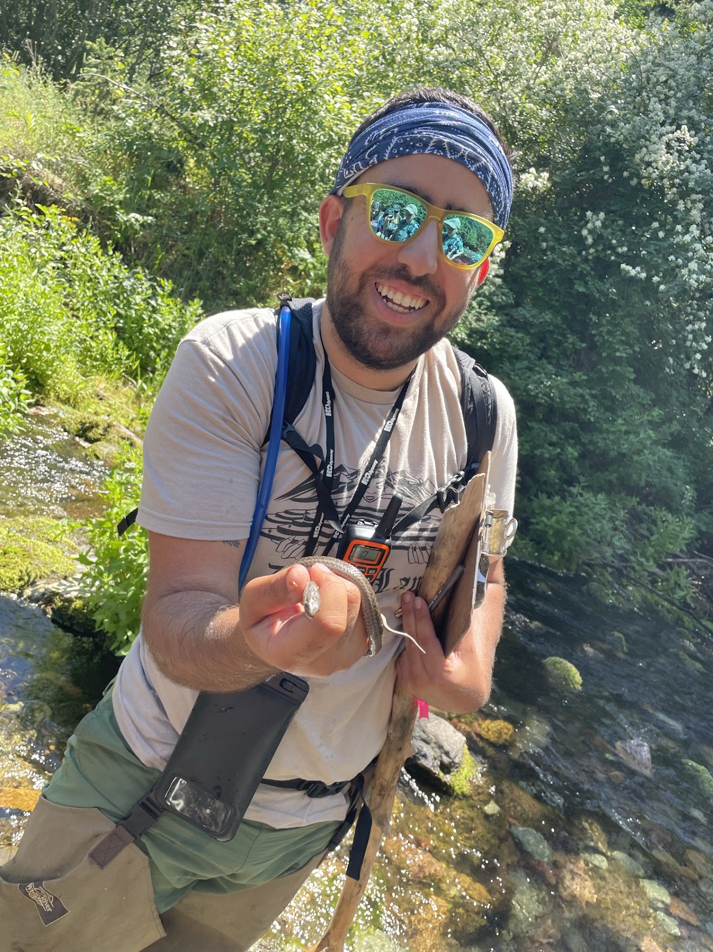
Chris in the creek


Chris Jadallah is a PhD candidate in Science and Agricultural Education at the University of California, Davis where he works with the Center for Community and Citizen Science. Learn more about the Center and its work on their website


Western Montana’s Rattlesnake Creek and its many relations - human and more-than-human - are at the heart of our ongoing research-practice partnership between Watershed Education Network (WEN) and the UC Davis Center for Community and Citizen Science. As part of this partnership, I was fortunate enough to visit Missoula this past summer to collect data that will help us document how WEN’s Stream Team and Backcountry Stream Corps programs are fostering community impacts in the Rattlesnake Creek watershed and beyond. 


Both Stream Team and Backcountry Stream Corps feature community-based monitoring - a type of citizen science - as core program features. Through these efforts, local residents and volunteers are collecting biological, chemical, and physical data relating to ongoing restoration efforts in the watershed, of which the 2020 Rattlesnake Creek Dam removal was a defining feature. Ultimately, this data will be shared with partners such as Trout Unlimited and Montana Department of Fish, Wildlife, and Parks to adaptively manage the dam site in support of diverse social and ecological goals, from increasing fish passage to providing more recreational opportunities for Missoulians. 


As an educational researcher, I am particularly interested in both what and how people learn through participation in community-based monitoring and other environmental activities, as well as the broader role that this learning plays in supporting a thriving future for places like Rattlesnake Creek. My research examines individuals’ relationships’ both with each other and with the natural world as resources for collective learning and change, focusing on changes in the the broader community rather than solely on what individuals gain through participating. If well-designed, citizen science activities like Stream Team and Backcountry Stream Corps have the potential to set up lifelong learning and participation in and learning about science and the environment as embedded in community and in place. Ultimately, this can support communities in working better together to address social-ecological problems like dam removal as part of civic life.  


Throughout my visit to Missoula, I collected ethnographic data that we will use to describe, understand, and interpret how different people in the watershed experience and make meaning of their participation in Stream Team and Backcountry Stream Corps. On a typical day, data collection for me looked like either observations from my participation in field activities or interviews with project participants - both common methods in social science research. While observing volunteers in the field, I maintained a delicate balance of participating in the days’ activities to get a feel for the experience while also working to capture bits of conversation, landscape sketches, and descriptions of the groups’ work in my notebook. Sometimes I did this while wearing waders waist-deep in Rattlesnake Creek! Later, in the evenings and on weekends, I would process these scribbled jottings, hours of audio recordings of group conversations, and dozens of photographs into integrated narratives of each day’s happenings, with attention to how participants were engaging with each other, with the practice of science, and with the Creek. On days when I was not in the field for observations, I met with project volunteers, organizers, and scientists, ranging from high school to retirement age, for interviews. Most interviews took place at Greenough Park, where there was a natural ebb-and-flow between stories of people’s experiences participating in community-based monitoring intermixed with in-the-moment observations of the natural world around us. It was hot - so dipping our toes in the water was often a necessity, where we could also point out and observe macroinvertebrates scurrying about on the smooth rock surfaces underwater. 


Central to my commitments as a researcher is working to develop research-practice partnerships with partners like WEN. This stands in contrast to conventional and sometimes extractive modes of scholarship, in which a researcher passively observes subjects as an outsider and with little engagement otherwise. Reciprocity came to be a grounding principle in my relationship with WEN. Mundane moments that might be considered external to the research process instead proved to be a core element of the experience, from giving feedback on surveys while in the office between interviews, to chatting about program goals as we drove to and from monitoring sites, to facilitating reflective discussions with volunteers to wrap up fieldwork experiences. These conversations benefitted both WEN’s programs and my research as we learned from each others’ insights and perspectives, and deepened our relationships with each other as collaborators. 


Next steps for this work are to analyze all the observational and interview data, while inviting feedback from research participants, to identify what elements of WEN’s programs foster positive community impacts such as community science literacy and stewardship. These findings can be used to inform the design of community-based monitoring programs such as those at WEN, as well as the design of other informal learning environments in which scientists, educators, and local residents interact and engage with each other. We are so grateful for the opportunity to learn from WEN staff, volunteers, and partners, and look forward to sharing our findings.